
Drone Services
VISUAL INSPECTION
- HD Still Imagery
- 6K Video
- Thermal Imagery
- Security / Surveillance
Survey
- 2D / 3D Mapping
- Lidar Scanning
- Post Processing
BLADE INSPECTION
- Turbine Blade Inspection
Consulting
- Project Management
- Inspections
- Reporting
Training
- Aerial and Land Surveying
- 3D Modelling
- Post Analysis on Captured Data
Visual Inspection
Vertech Robotics make use of state-of-the-art drones that enable close visual inspection, internally and externally, to areas deemed difficult to access or time consuming to perform via the traditional routes of rope-access or erection of working structures such as scaffolding.
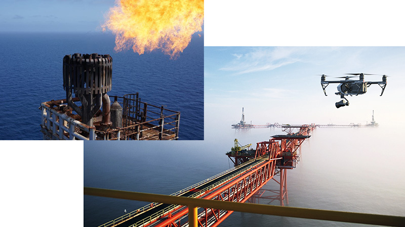
Security and Surveillance
Survey
Vertech Robotics offer an unrivalled, comprehensive state-of-the-art solution in Aerial/ Terrestrial laser scanning, by integrating UAV and LiDAR technology.
By generating an aerial 3D point cloud of your site, we can reduce the time, cost and complexity of inspections and surveying while providing a detailed 3D model of the area.
Using our advanced drones and sensors, Vertech can produce the following:
- Geo-Referenced Orthomosaics
- DEM (Digital Elevation Models)
- Dense Point Clouds
- 3D Models
- DTM’s (Digital Terrain Models)
- Quantities for stockpiles and open pit mines
- CAD drawings for planning and development
Visual Inspection and 3D Modelling
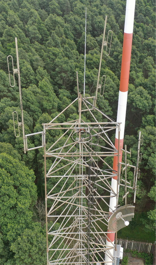
Vertech Robotics make use of digital captured data to obtain information on telecommunication towers & equipment.
- With drones & smart camera systems, Vertech make use of “stereophotogrammetry”, the art and science of combining two or more images with similar characteristics to build a 3d model.
- Gathering data onsite without any risks to the operators.
- Captured data goes through several processes to get a scaled 3d model of the actual structure in the field, “we bring the site to your office”, resulting in minimal time out in the field.
- Improved accuracy in inspections results and surveying of more towers in a single day, compared to the traditional methods.
In the Telecommunication industry, we can offer the following services:
- Structural surveys
- TSSR surveys
- Line of sight surveys
- Signal strength tests/drive test
- Loading analysis
- Foundation analysis
Survey
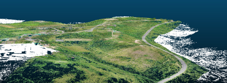
- Photogrammetry 3D data overlay on Lidar captured data.
- Digitising terrain & structures with pinpoint accuracies.

Vertech Robotics work with market leaders to offer the latest technologies for inspections in the renewable energy sectors. Making use of Thermal, Lidar, HD camera’s & state-of-the-art software, Vertech can now offer autonomous inspections, that proved to be time & cost saving solutions to our clients.
Renewable sectors:
- Onshore & Offshore Wind
- Concentrated Solar (CSP)
- Solar Photovoltaic (PV)
- Hydroelectric

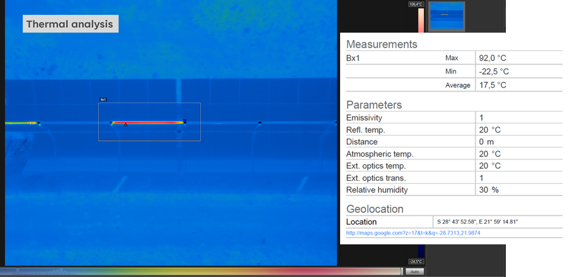
CSP Survey

New Technologies
Vertech collaborated with an international computer vision technology company, who designed a computer vision, artificial intelligence/machine learning device, integrated with a Vertech drone, to detect & inspect Wind Turbine Blades autonomously, to offer the best combination of safety, quality, speed and cost on the blade inspection market.


Turbine Blade Report

